Hiking Etiquette, How to #RecreateResponsibly in Truckee
Have you been pining for open trails and endless mountain miles? You’re not the only one. Truckee’s vast hiking trails welcome you back but ask that you #RecreateResponsibly.
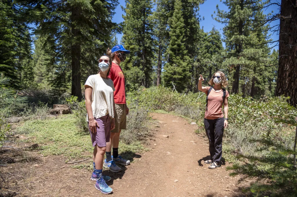
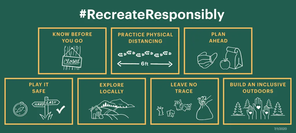
COVID-19 Hiking Etiquette: DOs and Don’ts
Hiking Etiquette Dos:
#1 Do plan your trip for off-hours and avoid peak hiking times. The best times to hit the trail are usually early morning or late afternoon. Get up early to watch the sunrise and avoid thunderstorms, or plan a shorter sunset hike in the evening. If the parking is tight or congested, choose another trail. Park safely in designated parking spots only.
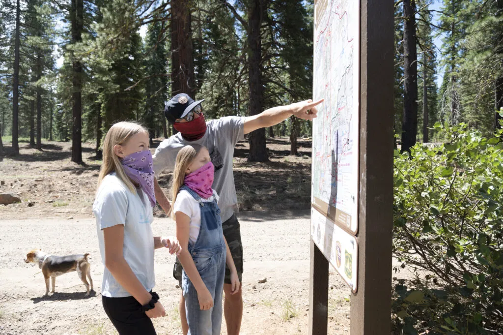
#2 Do read signage posted at trailheads to learn about local closures and restrictions. Whether you’re hiking in a National Forest or National Park, it’s important to check on closures and restrictions in place. Be flexible and ready to change plans if needed.
#3 Do follow Leave No Trace on the trail. Observe these seven principles to leave no trace while you are hiking. Remember to pack everything out, including your germs!
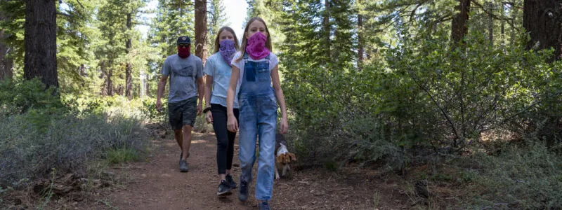
#4 Do go to less traveled trails near Truckee. Seek out remote hiking trailsnear Truckee where you can easily avoid other hiking parties. Plan for off-the-beaten-path hiking and explore less frequented zones in the Tahoe National Forest.
#5 Do understand hiker/biker etiquette and who has the right of way on narrow trails. The rule goes: mountain bikers yield to hikers, hikers moving downhill yield to hikers moving uphill, and mountain bikers moving downhill yield to mountain bikers moving uphill. In reality, it’s usually easier for a single party to move out of the way of larger parties. And because mountain bikes move much faster than hikers, it’s sometimes easier for hikers to yield to mountain bikes. Use your best judgment and always be courteous of other trail users.
Hiking Etiquette Don’ts:
#1 Don’t assume services will be available at the trailhead. Many public restrooms, water, and garbage facilities are closed at this time. Always check on current trail conditions and operations before you go.
#2 Don’t go to crowded trails, beaches, campgrounds, etc. Choose off-the-beaten-path hiking trails, like Mt. Lola, where you are less likely to come in contact with large numbers of hikers. Use the trailhead parking area as a gauge and if parking is congested, go elsewhere to a less crowded trail. Always park safely in designated parking spots only.
#3 Don’t have a campfire or burn any solid fuels while hiking or camping. A district-wide fire ban is in effect as of June 3, 2021, in Truckee. STOP wildfires from burning down Truckee, prevention starts with you.
Experience Truckee’s Paved Paths Responsibly
Truckee’s paved paths can be busier than other hiking trails. In addition to the COVID-19 hiking etiquette outlined above, make sure to follow these guidelines to experience Truckee’s paved paths responsibly. Paths include the Legacy Trail, Trout Creek Trail, Martis Dam Road, and more. Discover Truckee’s 17 miles of scenic paved trails in this downloadable brochure.
- Walk or ride single-file on the far side of the trail to pass others
- Give more space to runners and cyclists
- Be kind and courteous to all trail users, especially high-risk individuals
Choose Off-The-Beaten-Path Hiking in Truckee, CA: Mt. Lola
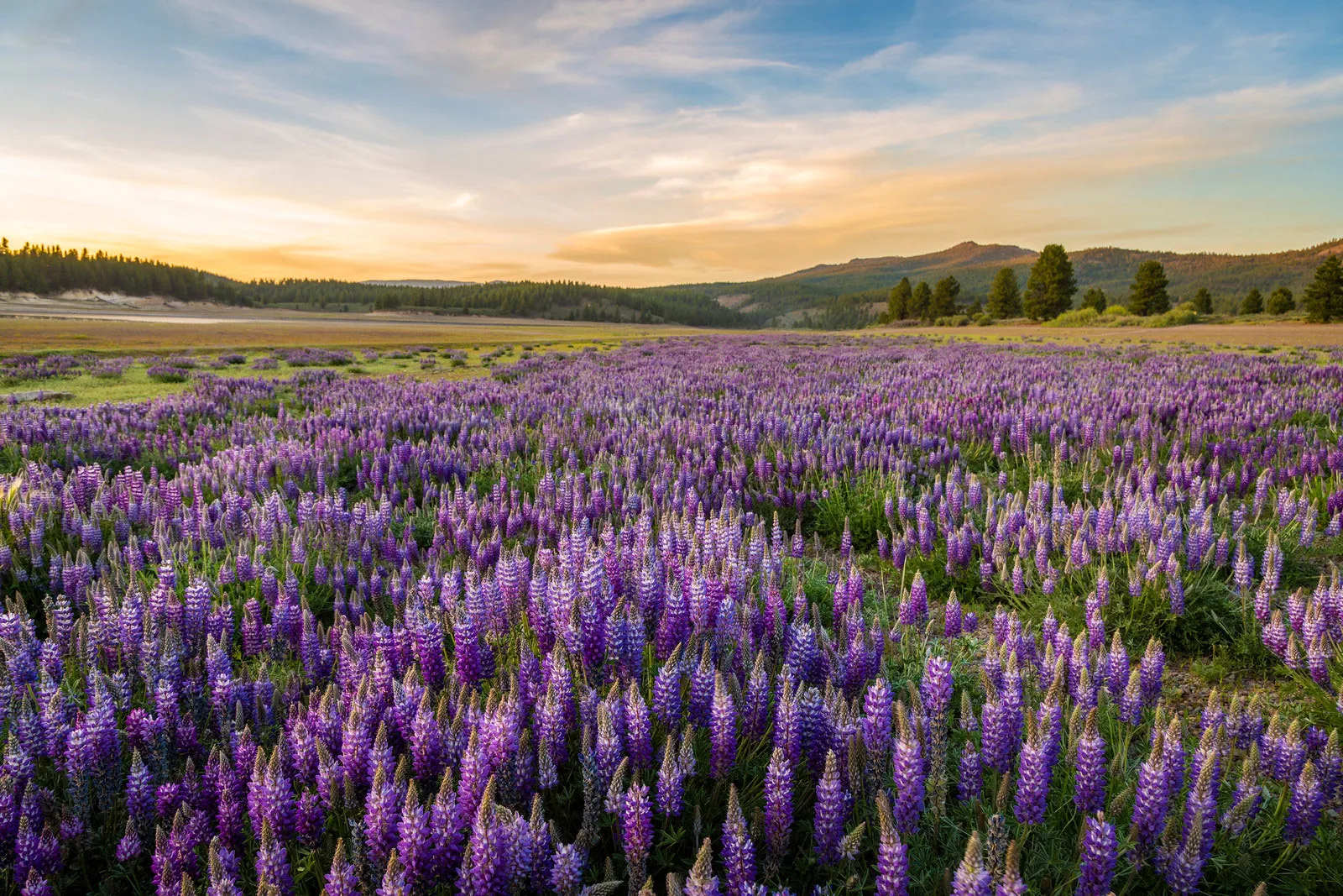
Avoid crowds by choosing an off-the-beaten-path hike like Mt. Lola. This moderate to strenuous day hike takes you up to the summit of the tallest mountain in the Sierra’s north of I-80 – Mt. Lola. It’s a great option to escape crowds and explore a rugged section of the Tahoe National Forest. You’ll begin your hike in a quiet, peaceful forest and climb up a to a long, scenic ridgeline with fantastic views into Independence Lake Valley all the way to the summit. Make sure to pack plenty of food and water, wear a face mask, and enjoy this off-the-beaten-path hike, a hidden gem near Truckee.
Distance – 10.4 miles
Elevation Gain – 2,532 feet
Route Type – Out and back
Difficulty – Moderate to strenuous
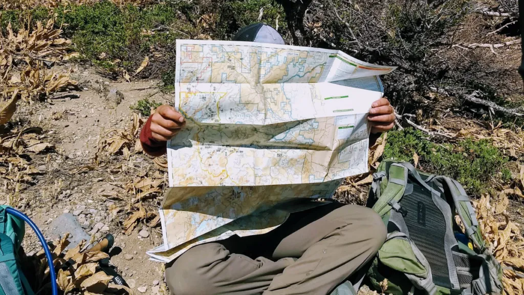
Most Truckee hikes look like this at some point. Always carry a map of the area and be able to determine your location on the trail.
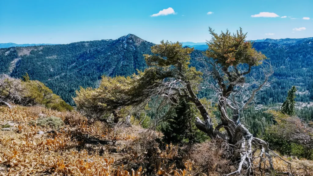
Cresting the ridgeline and beginning to gain views into Independence Lake Valley and beyond.
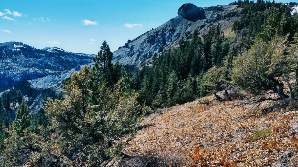
Looking towards the summit of Mt. Lola. From here, the hike is a scenic climb along an open ridgeline with many opportunities for photos.
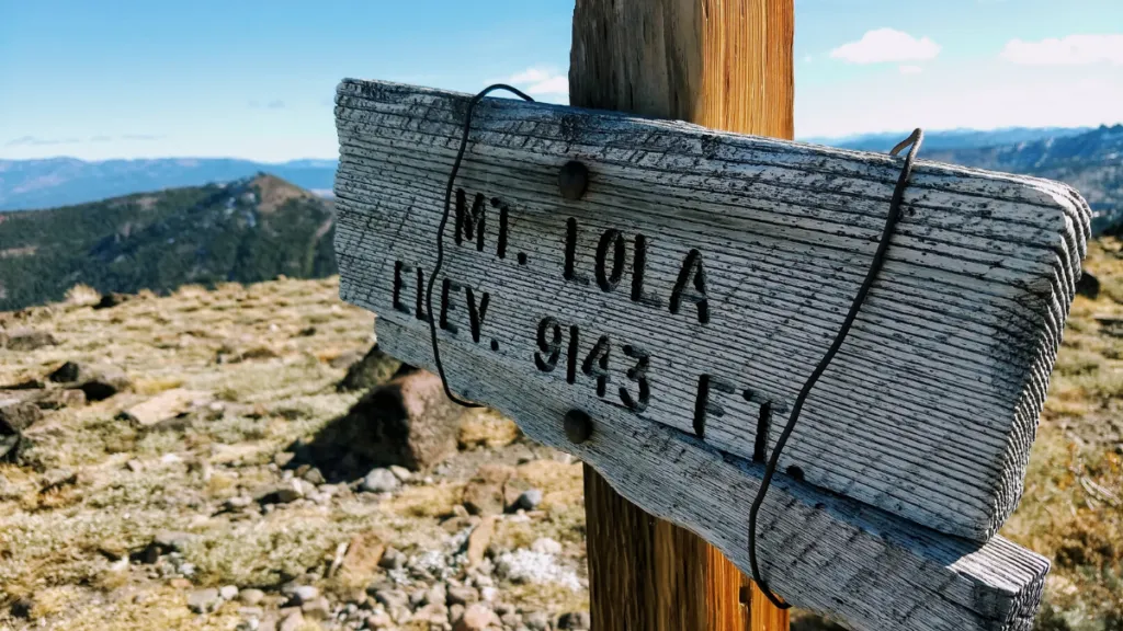
At the summit of Mt. Lola, the tallest peak in the Sierra’s north of I-80. Take in the360 degree views from 9143 feet.
Looking southwest from the summit of Mt. Lola. From this view, you can see White Rock Lake below.
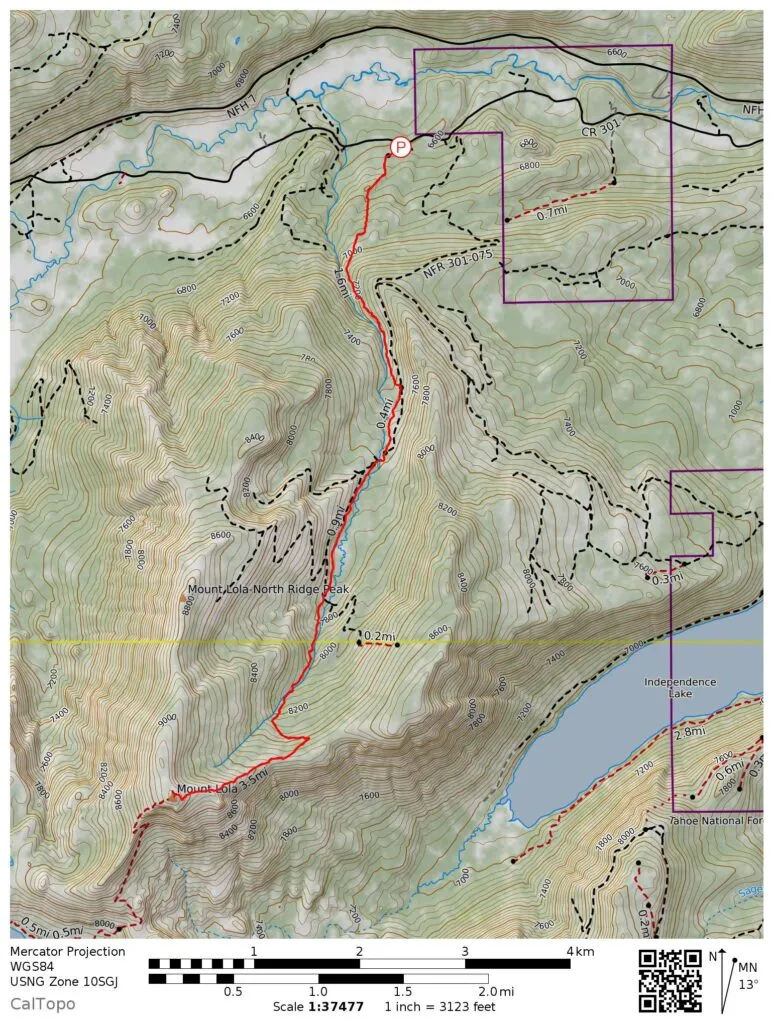
Mt. Lola Hiking Map

Driving directions to the Mt. Lola trailhead
Take 89 north from Truckee for 14.5 miles, turning left onto USFS Road 07. Drive for 1.5 miles to USFS Road 07-10, and follow this for 0.6 miles. Turn right on (unsigned) Henness Pass Road and drive for 3.1 miles to a road signed Mt Lola Trail.
Thank you for choosing to #RecreateResponsibly during your visit to Truckee!


Truckee, CA 96161